Showing posts with label desert. Show all posts

Wednesday, May 20, 2015

fish river canyon & ais ais hotsprings (namibia, april 2015)

After a few nights in the Richtersveld, we were ready to head further north into the Namibian side of the Ai-Ais/Richtersveld border park. We'd been camping along the Orange River and now it was time to cross it. 

When we arrived at Ai Ais, we were a little dismayed to find that there were no cold swimming pools. It was about 100 degrees Fahrenheit, and the only pool to be found was a hot spring that had to be about 95 degrees. Refreshing. 

After a couple of sleepless nights in still, humid heat, we were ready to see the Fish River Canyon and get outta dodge. Luckily the Canyon did not disappoint. It is the second-largest canyon in the world after the Grand Canyon in Arizona, and we were both impressed. 

Crossing the mighty Orange River on this barge! 


Jim loves a boat!


Jennifer at camp. Too hot for anything but our swimmies. That rain did not make it to us, but the rainbow was pretty.

Jim at camp one morning. No rain fly on this tent - we were desperate for a breeze.

Despite the definite "parking lot" vibe, Ai Ais did grow on us.

Off for a trek! The five-day hike through the Fish River Canyon ends here - we walked a bit of the end of the trail to see what we could see. 


A beautiful kingfisher!

THE CANYON

Sunday, May 10, 2015

the richtersveld (northern cape, south africa, march 2015)

This is the beginning of a 10 day trip into the Northern part of South Africa.  This is the place where Afrikaners fled to when Britain decreed that all slaves would become free people in 1830.  The Afrikaners refer to this mass-movement as the Great Migration.  Essentially thousands of black slaves carried Dutch settlers' stuff out into a narrowly hospitable climate (to be generous).

Our adventure was quiet at first as we needed to travel 950 km to our first campsite.  The final 48 km took longer than the first 250 km to put the remoteness of our exploration in perspective.

The single best event of the trip occurred when setting up camp after driving for 12 hours with the final 2.5 hours being the 48 km through a rugged two-track.  Needless to say we were tired, cranky, and hungry.  Accomplishing tasks such as putting up a tent, starting a fire, and preparing food in this sort of atmosphere is something that Jennifer and I do way too much on vacation.   Needless to say the situation was rife for disaster.

As Jennifer and I were trying to set up the tent we realized there was a layer of rock that would prevent our spikes from reaching far enough into the ground.  Considering the brisk wind that was blowing this meant we would likely lose our tent unless we found a new location.  So, I explored for a more suitable spot and found a good one (in my opinion, but not Jennifer's) about 10 meters away.  While I was searching for a new spot and sticking my spike into the ground, Jennifer was holding onto the tent to keep it from blowing away.

After finding my spot I thought it best to stand still while Jennifer carry the tent over--bad mistake.  Fatefully, the wind picked up and pulled the tent out of Jennifer's hands as she started to move towards the less-than-ideal new spot.  As the tent carried a few feet into the air, it moved just outside of Jennifer's grasp and began to tumble towards the rock field that ran next to the river (tent location and river indicated in pictures below).  The boulders that occupied the area within 50 meters or so of the river were large, sometimes sharp, and essentially not navigable at fast speeds.  

Jennifer was wearing two-strap sandals, so she took off after the tent.  I was barefoot, but quickly decided that should the tent be faster than Jennifer I would be best served downstream if the tent managed to lodge itself in the river.  I took off downstream to cross the rock field in a different place where the river narrowed to a deep section next to a protruding and tall rock that I could use as a spotting location.  

As I was working my way, not so quickly, across the rocks I could hear Jennifer begin to move into histerics.  Some crying, some shouting, general exasperation.  I just remember shouting to be careful crossing the rocks as I didn't want her to get her ankle twisted or hurt herself in a mad fury to reach the tent.  

When I arrived at the river's edge I was in position to talk to Jennifer so I called up stream, "Did the tent go in the river?", then "Yes".  "Did it sink", then "Yes".  "Can you see it", then "No, it hit and sank and went away and now its gone, I can't see it!"

So, I waited for a brief moment on my rock, thinking that the tent may be deep in the water as the river looked like it could be 20+ feet deep in the section below my post.  However, in a few seconds I could see the ghostly shape of the tent under the water--mostly thanks to the orange pieces.  As it was 30 minutes past sunset and we were still discussing the likelihood of the river having crocodiles (forgot to ask at reception 2.5 hours before) it was quite a scary moment for me.  But, to lose the tent when it was clearly within grasp would have been inexcusable.  

Upon jumping into the fast-moving and deep current, I found that moving the tent was much like trying to pick up 500 pounds, or move a hot-air balloon around with a rope on a windy day.  It was essentially impossible to move and pulling itself deeper into the water with the current.  To solve this problem, I pulled myself under water with the tent and began taking it apart to reduce its drag.  A sheet underwater will produce very little drag, so holding my breath for a few seconds I packed the tent down and began to swim it towards the surface/shore.  Thankfully, I was able to get myself into a counter-current eddy that formed below my big rock outcropping and the current actually pushed me back up against the rocks.  Tent saved!  Adventure had!

The climate was so hot and dry that even without the sun the tent dried in a matter of minutes.  Following this episode we had lots of laughs and decided to keep heavy rocks in the tent at all times.

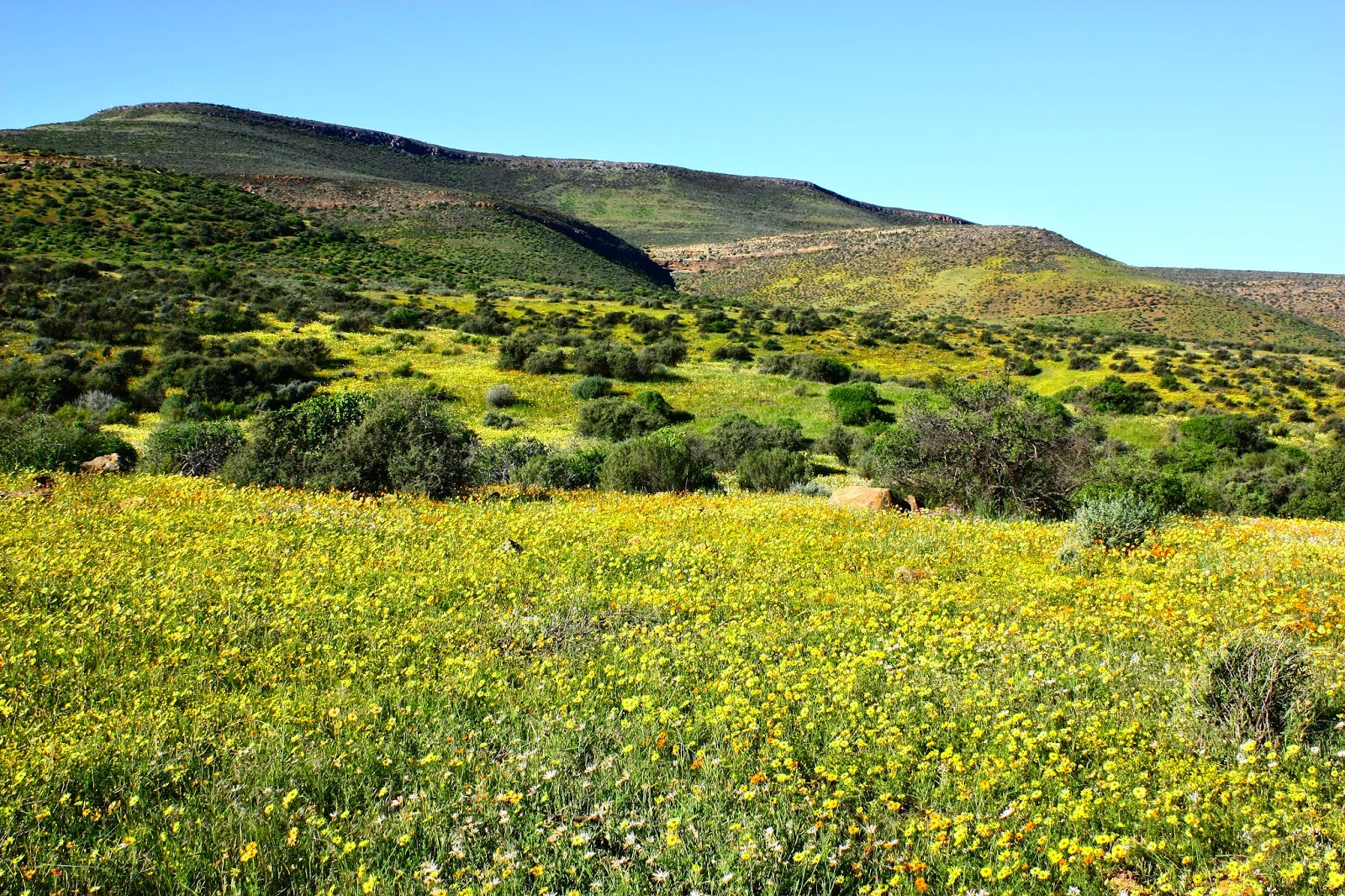
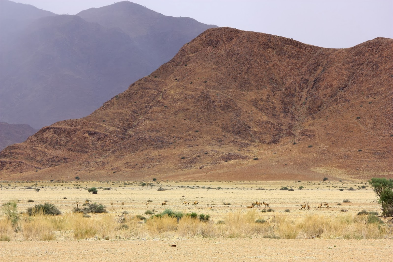
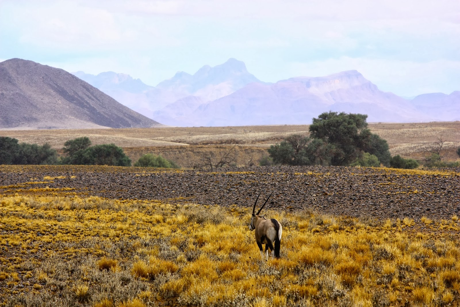
The rest of the trip was not as interesting, thank goodness, but we did have good fun exploring the desert wilderness.


The rolling, smooth hills are formed by gneiss intrusions--a form of granite that penetrated into the crust of the African and South American crustal plates as they separated ~130 million years ago.

This is not the dirt 2-track mentioned above--it is road through mining areas heading into the Richtersveld.


Monday, March 23, 2015

wildflowers, spring 2014 (clanwilliam, south africa)

We were busy this "spring" and never got around to posting these photos from our wildflower-viewing weekend in September.

Every spring in the dry veld of the Western Cape (north and west of Cape Town), a really magical bloom of wildflowers takes place. The absolute best ones are supposedly about 7 hours away in Namaqualand; we didn't make it that far, but we did get to Clanwilliam this year and really enjoyed the weekend driving through fields and exclaiming over the colors.

We're heading back up this way next week for our last trip in southern Africa before we head back Stateside. As you can see from our lack of posting on the blog, this year has been busier than last with fewer weekend trips - we're not exactly tourists here any more! But we are looking forward to getting out for a few more long weekends and taking advantage of school holidays before we leave Cape Town permanently in June. (Tears are forming just thinking about it!)

Til then, enjoy a few sunny flowers now that it's turning to spring in the northern hemisphere!


Thursday, January 23, 2014

day 9: desert in the rain, naukluft to sesriem (namibia)

We left our beautiful private campsite in the desert to head to one of the most popular sites in Namibia: the sand dunes at Sossussvlei. It was a rainy day, which meant the temperatures were cooler and the grazing animals - oryx, springbok, wildebeest and red hartebeest - were out nearly all day.

After a few stops to take pictures and hang out with oryx and springbok on the side of the road (there are extensive fences along every major road in Namibia, but animals seemed to get past them pretty often), we arrived in Sesriem, the campsite nearest to Sossussvlei. Sesriem is the gateway to a long, narrow valley that transitions from rocky hills and grassland to the start of the amazing sand dunes of the Namib desert. At the end of the valley, 60km down a paved road and another 4km down a sand road, lies Sossussvlei. "Sossuss" means "the place where water gathers" in Nama, the primary local language of this region of Namibia, and "vlei" means "valley" in Afrikaans. So "Sossussvlei" is literally, "valley valley." We didn't make it all the way there on this day, but did climb our first dune (Dune 45, at Kilometer 45 from the campsite) and watched the sunset. This made for a few good pictures, but a harrowing drive back in the dark, racing to beat the gate (which closes an hour after sunset).


One oryx is outside the fence and the others are inside. He held his ground until we got too close, then turned and ran off, then realized he was limited by the fence, and turned and ran back at us. A lot of the oryx we saw did the "bluff" behavior, holding their ground until they realized how big our truck was.

Looking back over the Naukluft Mountains.

Now we're in the park, and the fences are gone. It had finished raining shortly before we headed out on this drive.


We liked this guy :)


The sand dunes are starting just to the right.

Saturday, January 11, 2014

day 4: damaraland (namibia)

Day 4 began and ended in Damaraland, which did not involve much driving--yay!  The big hit of the day was the San art rock engravings that date from 2,000 to 6,000 years old.  The site is called Twyfelfontein, which means 'doubtful spring' because the amount of water coming out was considered to be too small for permanent human occupation.  However, the spring has continued to bubble constantly over the past 65 years or so--the time of the first white occupation following World War II.  Yes, the first white occupation was after WWII, wow--that was the time period when emigrated Germans and Afrikaners forcibly removed the native people from this land.  

Before the sun arched too high Jennifer and I climbed to the top of a large ridge line, forging a hiking trail of our own, in order to look out over the plains.  This was one of our best panoramas.  You will note the white and black surfaces that look scorched from fire, but are actually the color of exposed rock.  The white rocks are quartz and the black rocks are a volcanic intrusion that is similar to basalt.  

These vertical rock columns are called the organ pipes--you can see why--and were exposed through a stream eroding the landscape and cutting through the rock.


This is an interesting rock formation--next to the basalt intrusion on the left we have a different type of mineral form that I haven't identified.  It is shiny and gray and flakes apart in thin planes.  If you know something about this rock/mineral please let me know.  It seems to have formed in the cooling process after the magma intrusion.

This is the "burnt mountain" that is actually just exposed rock.

A rock with significant iron deposits--you can tell from the orange rust.

Very interesting to note that the white sections of this picture are actually exposed white quartz.